The Solutions Explorer lets you create alerts that match your needs. You can create several alerts and you will receive a notification each time a new Solar Impulse Efficient Solutions is labelled and matches your filters.
Your Search Alerts will show up here.
Sign in to create alerts for your filters and search terms.
Sign inDon't have an account?
Sign upAccess exclusive opportunities for Investor Members Only
The Investment Hub is a platform by the Solar Impulse Foundation that connects innovators with investors to fund scalable and sustainable solutions. Through tailored matchmaking, e-pitches, and a collaborative digital environment, it helps drive impactful innovation forward.
Sign in to explore a world of dynamic and high-potential investment opportunities.
Sign inDon't have an account?
Sign upJuly 1, 2023
Keolis Rennes
Rennes
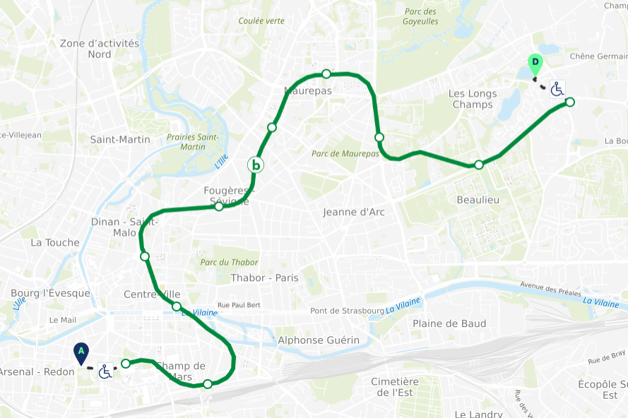
In Rennes Metropole, improving pedestrian accessibility and transportation networks is a priority. The goal is to optimize mobility across the area, especially for people with reduced mobility, individuals with disabilities, the elderly, or young parents with strollers. To achieve this, the city has decided to make all its road data publicly available. This data feeds into our route calculator, providing precise information to travelers. For the past year, Handimap has been integrated into the application and website of the STAR transport network (bus, subway) in Rennes Metropole. Available in 43 municipalities, it processes around 100,000 routes everyday. This service offers accessible routes by taking into account various factors such as the condition of sidewalks, crossings, public transportation, terrain topography (slopes, steps, sidewalk width), and any ongoing urban construction work.
The integration of Handimap into the STAR transport network promotes pedestrian mobility, the lowest-carbon mode, and encourages public transit use over private cars. It reduces the environmental footprint by 84.17% compared to demand-responsive transport, based on Solar Impulse certification calculations. Economically, Handimap cuts route adjustment costs, improves user experience, and strengthens partnerships between Keolis, Rennes Métropole, and Someware, supporting the regional ecosystem.
Handimap is a pedestrian and PRM route planner, already installed in 87 towns and cities in France, designed to meet the specific needs of inclusive urban mobility. It generates accessible routes for pedestrians, PRMs, senior citizens and other users, incorporating theoretical accessibility data (gradients, pavement widths) and real-time data (roadworks, obstacles). Its accuracy and multimodal coverage (walking, bus, tram, metro) make it a unique solution given the limitations of conventional calculators. Handimap has already been integrated into the STAR network in Rennes and via the HITinéraire application in Lorient, where it optimises public infrastructure, promotes local commercial activity and encourages soft, sustainable mobility. By making towns and cities more accessible and inclusive, Handimap is positioning itself as an essential tool for urban mobility that respects the environment and is adapted to the needs of all users.
Share
The information set out above, is solely for the purposes of information and the Solar Impulse Foundation does not provide any guarantee as to its authenticity, completeness or accuracy. This information does not constitute investment advice or a recommendation to buy into, transact or to enter into any agreement with any of the parties or persons mentioned above. Potential investors or interested parties are solely responsible for their investment or business decisions and for performing any due diligence required by the circumstances. The innovator has asserted ownership of the intellectual property rights for images, videos, and content showcased above, affirming full and unrestricted usage rights, and has provided explicit permission for the Solar Impulse Foundation to publish such information designated as "public" in the application form.